Drones began to be sold some time ago as very expensive toys, something like today’s remote-controlled cars. However, the authorities soon realized dangers which means that anyone can use one of these devices. For this reason, regulations such as flight permits were launched. Another system that is being implemented is the identification of each drone which is in flight. And that is precisely what the app that we are going to talk about today does.
Identify a drone with Drone Scanner
Both the United States and Europe have established strong regulations around drones. Brands have had to make a move to adapt to the new laws. Heavier drones can now only be operated by people who have a license, while lighter models can be used by anyone of legal age. But that’s not the thing. One of the points on which a lot of work is being done is the drone identification.
the czech company drone tag works creating remote identification systems for drones, which will allow other manufacturers to comply with the new regulations that are emerging around these devices. One of its latest products is Drone Scanner, a free application for iOS and Android devices that allows you to track all fenced drone flights thanks to data from remote ID they issue for identification.
This app is the equivalent of Flightradar24, but for drones instead of planes and helicopters. Drone Scanner uses the Wi-Fi and Bluetooth receivers of a mobile device to capture the data transmitted by a drone with remote ID. Specifically, the app leverages Bluetooth 4, Bluetooth 5, Wi-Fi Beacon, and Wi-Fi NAN protocols to extract detailed information about drones flying nearby in real time.
What is Drone Scanner really for?
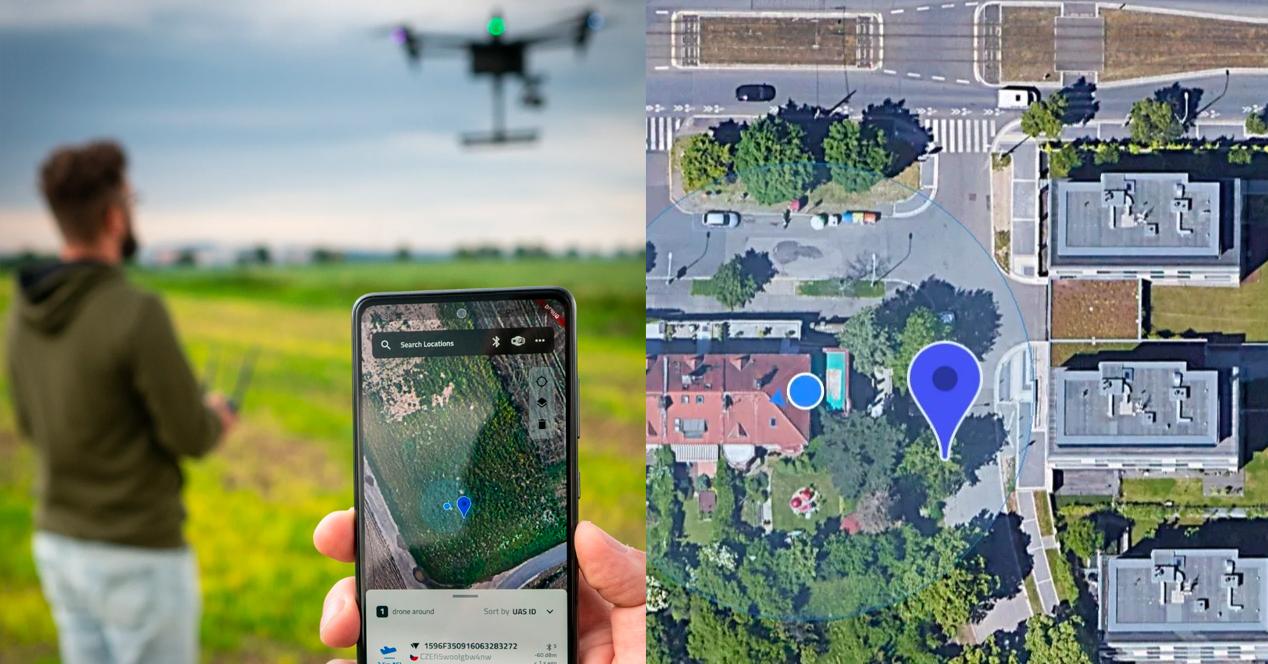
According to Dronetag, DroneScanner It is mainly used so that you can examine a detailed map with all the drones you have around you. The application shows in detail and in real time important data such as the height which they meet, the address and the location history. It also allows you to see the flight zones marked on the map, as well as allowing you to easily visualize the areas in which it is not allowed to fly a drone, either because it is a military zone, a nature reserve or because you are close to an airport.
In addition, the application allows export the data easily collected in case you need them in the future. This is interesting both for research work and in case of having to report a user.
Dronetag ensures that it will update the application continuously to reflect the latest European and American regulations about drones. However, a new debate opens. What happens to the information transmitted by drones? Could any user collect all this data and misuse it? These are the new challenges that Dronetag will have to face soon.
If you are interested, you can download the application in the Play Store of Google or in the app store from Apple.