The Google Earth platform allows us to travel anywhere on the planet without leaving home comfortably from our PC. We just have to select the place on the planet we want to visit, zoom in with the mouse wheel and move to the place we want to see from a bird’s eye view. However, this Google platform, in operation since 2001 under another name until it was bought by the search giant, is much more.
Google Earth makes available to us not only information from a bird’s eye view, but also allows us to travel back in time, see how the planet has evolved, demonstrate our knowledge and much more.
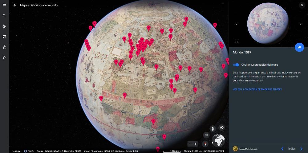
travel to 1587
One of the most curious functions of Google Earth is the possibility of seeing what the planet was like hundreds of years ago using the information that is still preserved from that time and that Google has adapted to the shape of a globe to make it easier to see. How history has changed over the years.
This information is available in the section historical maps. In the column on the right, it allows us to see plans of what the geographical and political distribution of that time was like. This information is classified by age range: from 1550 to 1700, from 1700 to 1750, from 1750 to 1800, from 1800 to 1850, from 1850 to 1900 and from 1900 to 1950.
We also have access to maps of Spain in 1701, of the city of Paris in 1716, of Moscow in 1745. In addition, it is also available as a globe in 1587, 1790 and 1812. Within the options of this functionality, we can explore the content, in addition to by year, by sites and by scales. To access the historical maps of Google Earth, called Rumsey Maps, we can do it through this link.
Check the changes on the planet
One of the most striking features of Google Earth is the ability to see how the world’s cities and regions have evolved over the years. This function, available through the section Explorerin the section Timelapse in Google Earthallows us to see in timelapse format the evolution of certain regions of the planet from the last decades to the present.
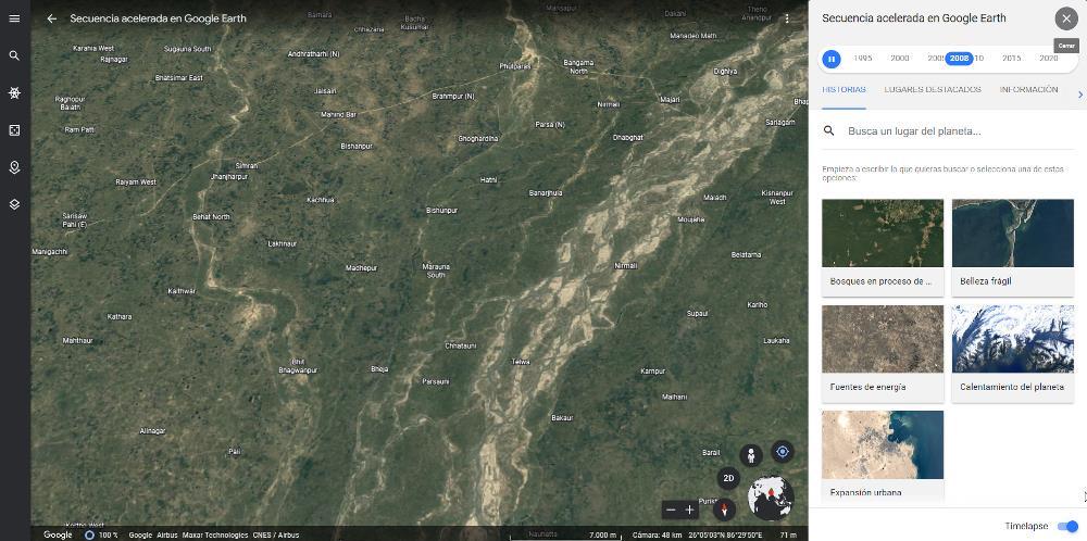
But, in addition, it also allows us to see a timelapse of any place in the world from 1984 to the present, an ideal function to see how time has passed and how our environment has been affected. This function is designed to see regions and populations, not to see the evolution of urban construction at street level.
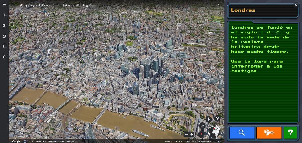
demonstrate our knowledge
Google Earth is an excellent platform to demonstrate our knowledge of general culture through this section, click on the Games tab. In this section, we can find different types of games where images are shown and where we must respond correctly to the place where they are located. One of the games available is the classic Where is Carmen Sandiego?
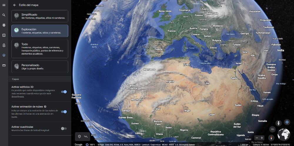
Cloud evolution in the last 24 hours
With Google Search we can also see how the position of the clouds has evolved in the last 24 hours, not based on weather forecasts, but based on where they have been and how long they have been blocking the sunlight. This feature is available via the Map Style tab, by checking the box Activate cloud animation.